-40%
No better book, gold mines, San Bernardino County, Calif, RARE 1st ed, BIG map !
$ 136.1
- Description
- Size Guide
Description
Last one in stock!BEST book on gold & silver mines
in San Bernardino County, California
NONE BETTER -- RARE 1955 first edition
locates 192 precious-metal mines
Mojave Desert mines in famous Atolia, Calico and Randsburg
districts; Twentynine Palms, Big Bear, Victorville, Daggett, MORE!
Includes HUGE separate map of all mines in county; text also
pinpoints most mines by range-and-township coordinates
GOOD CONDITION
Tiny detail of big separate map from pocket shows dense cluster of silver mines around the famous boomtown of Calico, CA. Every number here is keyed to mine name and exact township-and-range coordinates. Half-circles are silver mines.
T
his rare first-edition report describes and maps
every known gold and silver prospect
in 1955 San Bernardino County — about 192 mines in all.
Some of these mines were Southern California's most famous and richest — including mines near Dale (Twentynine Palms), Calico, Atolia and Randsburg; plus others near Big Bear, Daggett, Arrowhead Lake, Ivanpah, Goldstone, Victorville and Yucaipa.
Why buy a smaller report about just one of these areas when you can get this one, which covers 'em all? Sure the smaller reports initially
seem
like they are less money, but they end up really costing you much much more. By the time you collect all the smaller reports to cover the whole county, you'll have spent thousands of bucks.
At a glance:
What makes this
book so special?
— This rare first edition locates and describes every gold and silver mine in 1953 San Bernardino County, California! MANY of these mines are on public land, COMPLETELY accessible and open to the public. This is the LAST report by the state on these mines.
— Includes HUGE separate map in a rear pocket that shows all the mines, keyed to the text.
— You could wait
years
to find another first edition with all the maps in VG condition. The book is USELESS without the maps.
Nearly impossible
to find
And this first edition is harder to find than a snowball in Death Valley in July.
This is positively no-kidding the last one in stock, and it took us a year to find this one!
This is the last county-wide survey on mining in San Bernardino County produced by the California Divison of Mines and Geology. This is
not
some hokey piece of tourist claptrap. This book was produced about miners by miners for miners.
The press runs on the original reports were tiny, and collectors are just not selling them at any price these days. You don't have to be Einstein to figure out why. It would take you six months of visiting one mine a day to visit all the mines in this book.
More importantly, these county reports
are the ONLY place
where you'll find all these mines listed together. Usually, six mines will be in one report, another 10 in another book and so forth ... You don't need a pile of books if you have this one report. Plus, many of these mines (especially the smaller ones) are listed nowhere else, even in other San Bernardino County reports.
Don't pass this one up, thinking you'll see another first edition with all the maps in a couple of weeks. It ain't gonna happen. This copy is in great shape, absolutely one of the best that I've ever seen.
NOT a cheesy illegible reprint
Cheesey illegal reprints (from China and India) of some similar reports are now filtering into the market. But BEWARE: The photos from these reprints look like 1969 photocopies and are almost illegible. What's more: The reprints have +NO+ oversize maps. And the reprints are utterly useless without the oversize maps.
We have many MANY more rare mining books! Just visit our ebay store, Rare Mining Books:
http://stores.ebay.com/Rare-Mining-Books?_rdc=1
If these reprints were any good, we would sell them. But they're absolute junk.
The copy for sale here is NOT a reprint, but a first edition, totally out of print. This copy is in nice shape.
No guards, fences, barking dogs, no no-trespassing signs
MANY MANY of the locations in this report are completely accessible, deserted and open to exploring. You can go anywhere you want at these sites and pretty much do
whatever you want, when you want, as long as it's legal. (We do not condone or suggest mine exploring; we're talking the aboveground parts of these locations.)
There are no guards, fences, barking dogs or no trespassing signs. Most of these mines are miles away from any town of any size and are on federal Bureau of Land Management lands, which are are COMPLETELY open to prospecting and mineral collecting.
Headframe and 50-ton mill of the Virginia Dale Mine, Dale mining district, near Twentynine Palms.
Not some hokey rockhound
book for tourists
As I said before, this is NOT some hokey rockhound book for tourists that just lists 20 or 30 of the best-known gold mines in San Bernardino County. Let's face it — everybody and their grandmother already have picked clean the best-known sites. This report lists every single gold
deposit in the county — big and little, famous and
forgotten, mines that made their owners rich (and mines that have yet to make their owners rich).
The report also lists the more obscure deposits, which were initially underrated but went on to produce piles of cash for their lucky owners. Many of these are nearly forgotten sites and ghost towns awaiting rediscovery. Who knows how many of these properties are still
underrated, with riches just waiting for a prospector to finally dig a little deeper in the right place.
And this 62-year-old report describes all of the county's mining operations, both unprofitable and fabulously successful. These descriptions run from a few lines to several pages, depending on the importance of the mining operation. Locations of all mining sites are given, sometimes using landmarks, but almost always using
infallible range-and-township coordinates
. Just plug 'em into your GPS or look 'em up on the appropriate topo, and you're there! Mines are also pinpointed on a large separate map.
Also a valuable tool for stock certificate collectors
Because this report also lists mine owners and different names for the same mine, it is also a valuable tool for collectors of stock certificates. Some mine descriptions contain brief histories of the mines in question (including dates of actual production) and previous owners.
Another tiny detail of big separate map from pocket shows dense cluster of mines just north of the tiny ghost town of Cima in the East Mojave Desert. Every number here is keyed to mine name and exact township-and-range coordinates. Symbols denote type of deposit; circles are gold mines. Triangles are lead-silver mines.
Rich gold, silver and tungsten mines
Gold is the most widely distributed metal of commercial value in San Bernardino County, the largest county in the US. Gold-bearing deposits are scattered throughout the county — from the Slate Range near Panamint Valley to the Whipple Mountains in the southeast; from the slopes of the San Gabriel and San Bernardino Mountains in the southwest to the Clark Mountain area in
the Northeast. Gold was the predominant metal in 27 of the 45 mining districts of the county.
From 1880 to 1950, mines produced ,148,353 in gold.
As for silver, the Calico district alone produced – million in silver from just 1882 until 1896. Tungsten? From 1915–1918, mines produced million in this valuable metal. The Atolia district had the largest body of high-grade tungsten ore in the United States,
"if not in the world."
At the time of this report, Atolia "remains one of the nation's principal tungsten sources." The ore was so rich and so immediately recognizable that miners used it instead of money to buy supplies in stores and food in restaurants.
As you can tell by now, this is not some gift-shop rockhound book. Prepared by the California Division of Mines, it's a treasure trove of information for history buffs, bottle collectors, stock certificate collectors, photographers, geologists, hikers, offroaders, rockhounds, prospectors — just about anyone interested in learning about, exploring or prospecting old mine sites in historic San Bernardino County. One big oversize map (see examples throughout this ad) and photos illustrate the 143 pages on mineral resources of this gold-rich county.
Mines described
Here are just a few of the mines described:
Alvord gold mine
, named after famed Death Valley explorer Charles Alvord — 16 miles north of Yermo. Gold occurs in a siliceous vein within crystalline limestone.
Bagdad Chase gold mine
— seven miles south of Ludlow. Mine is the principal source of gold and copper in the county, yielding more than
million of gold. Mine has continuously operated since 1940. The ore is much desired by smelters, so the owner is given special discount rates on smelting.
Blue Bell (Hard Luck) silver mine
— seven miles west of Baker, owned by F. C. Baker of Barstow. Mine was worked in 1949 and shut down in 1950 after shipping 80 tons of lead-silver-copper ore. The ore bodies are
unevenly distributed over about two square miles.
Black Hawk gold mine
— sometimes erroneously described as being in Kern County, it really is 2.5 miles southeast of Randsburg. Operated almost continually from 1896 until 1942, the mine yielded 0,000 in free milling gold alone. Horizontal workings total more than 7,500 feet (!!!) in length. Levels are at 100, 200, 250, 450 and 600 (!!) feet. The ore was treated in a five-stamp mill on the property.
Ozier gold mine
— on John Bull Flat in Holcomb Valley, near Big Bear Lake. This mine, inactive for 15 years, probably contains the most extensive workings in the Holcomb Valley area. The gold-bearing rock was highly hematitic and contained little quartz.
Brooklyn and Los Angeles mines
— in the Dale mining district, 30 miles south of Amboy, near Twentynine Palms; the Brooklyn vein is two to four feet wide and is exposed for 4,500 feet! Tailings alone are said to average a ton in gold. Mines were idle at time of report. On Brooklyn group of claims, there are three 750-pound stamps with a 30-ton rod mill.
Death Valley silver mine
— not in Death Valley at all, but near Cima, in the East Mojave Desert. In mid 1951, the Rose Marie Mining Company was rehabilitating the main Death Valley shaft, which had been heavily damaged by fire in June 1927. Before the fire, the mine had produced about 1,000 in ore. Stock certificates from this mine appear on ebay from time to time.
Mohawk silver mine
— on the west slope of Mohawk Hill, near Mountain Station, owned by the Ivanpah Copper Co. Development consists of three tunnels at different elevations driven northward into Mohawk Hill. Workings — including winzes, raises, tunnels, drifts and stopes — total over 2,500 feet.
Silver Rule silver mine
— on the northwest slope of the Kingston Range, about 17 miles southeast of Tecopa, owned by John Prato, Fontana. Ore assayed at 20–40 percent lead, seven to 10 percent zinc and 10 to 20 ounces of silver per ton! The mine was most recently operated in 1950 when 200 feet of tunnel were driven, and several tons of ore were shipped.
Salt mines
— Operations on the Bristol Dry Lake (near Amboy, north of Twentynine Palms) have produced 1.63 million tons of salt from 1912 until 1951. At the time of the report, the Bristol operation was the only active salt mine in the county, although reserves existed at Dale, Danby and Soda dry lakes; Cadiz Dry Lake and Searles Lake.
Central group of mines, in the famous Calico mining district
— five miles northwest of Yermo. The Silver King mine was one of the first and most productive operations in the district and had probably the longest and most successful operating history. Other claims in the group include the Wall Street, Red Cloud, Oregon, Josephine and Burning Moscow.
Famous Atolia Mining District
, biggest tungsten deposit in the US if not in the world, three miles southeast of Randsburg. Workings at the Union mine are most extensive in the district. Two mills are currently in use in the district.
And many more mines and prospects
, large and small, famous and forgotten.
Above: Aerial view of the West End Chemical Company plant. Searles Lake is at top. Part of village is at the lower right.
Upper right photo: Shows open-pit operations of Surcease mining Company on tungsten lode deposits. Atolia pit lies east of Union shaft. Scheelite-bearing veins cut quartz monzonite exposed on quarry face. Photo was taken looking east.
Filled with firsthand, not secondhand information
Okay, so you have a book by a "noted rockhound" or an "ace prospector." You might get lucky and find a couple of neat places, but you'll also hit plenty of
barren duds. Why? Because what rockhound, mine explorer or prospector in their right mind would give away their favorite productive locations? Not one.
Old buildings at the Bonanza King camp and town of Providence. Volcanic rock at top of hill and some of the underlying tuff were quarried to provide stone for many of the buildings.
What they will give you are directions to sites that are picked clean or second rate at best. Why rely on secondhand info when you can get it firsthand? I guarantee that most — if not all — tourist-oriented rockhound and prospecting books for San Bernardino County use this six-by-nine-inch report as a source for information. Other mineral locales for San Bernardino County in this report include ones for copper, iron, manganese, quicksilver, vanadium, asbestos, barite, fluorspar, garnet, gypsum, mica, magnesite, salines, borax, niter, potash, salt, soda, talc and others.
Where is San Bernardino County?
San Bernardino County is in southeastern California, bounded on the east by Arizona and Nevada; on the south by Riverside County; on the west by Los Angeles and Kern Counties; and on the north by Inyo County.
The book:
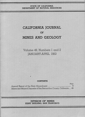
California Journal of Mines and Geology,
1953; Division of Mines, San Francisco, six by nine inches, 192 pages total, about 144 are about
San Bernardino mines and mineral resources, by Lauren A. Wright, Richard M. Stewart, Thomas E. Gay Jr. and George C. Hazenbush; first edition.
Interior pages are very good, except for some slight brown spotting, with some stamps by the previous owner and some scribbling here and there. The oversize ORIGINAL maps and separate charts are also in super nice shape. Folds are strong.
Issues are pretty much limited to some minor soiling, bumped corners and light general wear. Scuffed spine. Sounds much worse than it is. A nice copy in very good shape with a generally very nice interior. You will be hard pressed to ever find one in any shape, so buy it now or kiss it goodbye.
As always, I am
extremely
conservative about rating book condition and very detailed in listing any potential flaw, no matter how slight.
Payment methods and domestic shipping
Paypal only. Shipping is FREE via priority mail. I pride myself on bulletproof packaging and ship in sturdy cardboard boxes or in reinforced envelopes.
Returns
I have been doing this a long time, so I am very aware of all the scams. You can return this book if it is not as described, but look at the minute detail in this ad. That's not going to happen. You CANNOT return this book after you photocopy it so that you get all the info for free.
The fine print:
Feel free to contact me if you have any questions about the item or terms of sale.
I post feedback once a week. Not responsible for typographical errors.
Good luck and thanks for looking!
View southeast toward 325-foot vertical shaft on Contention claim of Big Horn gold mine in the southeast end of the Providence Mountains. Veins at the mine ranged in width from a few feet to over four feet!
Nearby counties and cities
Nearby counties
include Imperial, San Diego, Ventura, Santa Barbara, San Luis Obispo, Kings, Tulare and Mono.
Other San Bernardino County cities and interesting sites (besides the ones previously mentioned in this ad) include: Adelanto, Alta Loma, Amboy, Apple Valley, Barstow, Barnwell, Baker, Big Bear Lake, Bloomington, Broadwell Dry Lake, Cadiz, Calico, Chino, Cima, Colton, Cucamonga, East Mojave, Essex, Etiwanda, Fontana, Forest Falls, George Air Force Base, Goffs, Grand Terrace, Havasu Landing, Helendale, Hesperia, Highland, Hinkley, Ivanpah, Joshua Tree National Monument, Kelso Dunes, Lake Arrowhead, Lanfair Valley, Loma Linda, Lucerne Valley, Ludlow, Mentone, Mitchell Caverns, Montclair, Morongo Valley, Mountain Pass, Mt. Baldy, Needles, Nipton, Ontario, Oro Grande, Parker Dam, Phelan, Pinon Hills, Pisgah Crater, Pomona, Rancho Cucamonga, Redlands, Rialto, Riggs, Route 66, Silver Lake, Soda Dry Lake, Upland, Twentynine Palms, Turtle Mountains, Yermo, Yucca Valley, Ward Valley, Zyzzx.
